Wrangell-St Elias National Park Landcover Mapping Project

Services

The Importance of Landcover Mapping in Wrangell-St Elias National Park

Welcome to the Wrangell-St Elias National Park Landcover Mapping Project page, brought to you by Kimografix. As an Arts & Entertainment - Visual Arts and Design company, we believe in the power of mapping and remote sensing techniques to preserve the natural beauty and ecological diversity of our national parks.

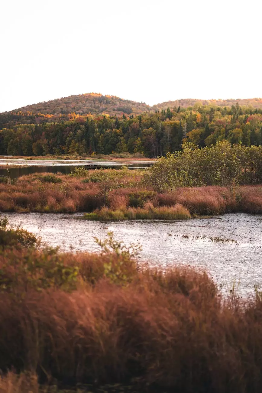
Located in Alaska, Wrangell-St Elias National Park is the largest national park in the United States, spanning an impressive 13.2 million acres. With its stunning glaciers, majestic mountains, and diverse wildlife, the park offers a unique opportunity to study and protect one of the world's most pristine ecosystems.

The Challenge of Mapping a Vast and Remote Park

Mapping such a vast and remote area like Wrangell-St Elias National Park comes with its own set of challenges. Traditional ground-based mapping methods are time-consuming, expensive, and often impractical due to the park's rugged terrain and harsh weather conditions.

This is where remote sensing techniques play a crucial role. By utilizing satellite imagery, aerial photography, and other advanced technologies, we are able to collect extensive data on the park's landcover types, vegetation, and overall landscape composition.

Advanced Remote Sensing Technologies

Our team at Kimografix leverages cutting-edge remote sensing technologies to map the landcover of Wrangell-St Elias National Park. By combining data from various sources, including high-resolution satellite imagery and LiDAR (Light Detection and Ranging) technology, we are able to create detailed and accurate maps that provide valuable insights into the park's ecosystem.

LiDAR, in particular, allows us to measure the height and density of vegetation, distinguish between different landcover types, and even detect subtle changes in the landscape over time. This technology is revolutionizing the way we study and monitor our natural environments, enabling us to make informed decisions for their conservation and management.

Preserving the Natural Beauty for Future Generations

The landcover mapping project in Wrangell-St Elias National Park is not merely an academic exercise; it has real-world applications in preserving the natural beauty and ecological balance of the park. By understanding the distribution and characteristics of different landcover types, park managers and conservationists can develop effective strategies for habitat restoration, wildlife protection, and sustainable land use practices.

Protecting the Fragile Ecosystems

Wrangell-St Elias National Park is home to diverse ecosystems, including temperate rainforests, alpine tundra, and glaciers. Each of these ecosystems supports a unique array of plant and animal species that have adapted to the harsh climatic conditions of the region. Through our landcover mapping project, we aim to gain a comprehensive understanding of these ecosystems, their vulnerabilities, and the threats they face from climate change and human activities.

Armed with this knowledge, we can develop targeted conservation plans and advocate for policies that protect these fragile ecosystems for future generations. By using our expertise in visual arts and design, we can communicate the importance of these conservation efforts to a wider audience, fostering greater awareness and appreciation for the natural wonders of Wrangell-St Elias National Park.

Conclusion

The Wrangell-St Elias National Park Landcover Mapping Project by Kimografix stands as a testament to the power of remote sensing and mapping technologies in understanding and preserving our natural environments. Through the detailed analysis of landcover types, vegetation patterns, and ecosystem dynamics, we can make informed decisions that ensure the long-term sustainability of this magnificent park.

Join us in our mission to protect the ecological diversity and natural beauty of Wrangell-St Elias National Park. Together, we can create a future where nature thrives and future generations can experience the wonders of this extraordinary national park.

Comments

Shelley Brady

Love preserving our national parks! ??

,

⛰️ The majestic landscapes of Wrangell-St Elias National Park will be better understood and conserved through this mapping project.

Ebsbag Ebsbag

? This initiative aligns with the global goal of promoting sustainable land management and conservation.

Holly Thompson

I'm impressed by the dedication of the team to produce comprehensive and accurate landcover maps for the park.

Arun Elangovan

I believe the landcover mapping project will provide a valuable foundation for adaptable and future-proof conservation and management plans.

Antoine Trien

Using mapping technology to understand and protect the natural environment is truly commendable.

Patrick Bobb

The landcover mapping project aligns with the park's broader vision to preserve ecological integrity and cultural resources.

Kacey Mhrm

I hope the landcover maps will serve as a valuable resource for educators, researchers, and policymakers.

Jason Todd

? This project signifies a shared responsibility to protect and conserve the natural heritage of our cherished national parks.

Simon Jones

Mapping the diverse landcover types will provide crucial data for adaptive and resilient management of the park's ecological systems.

William Tomlinson

I believe the landcover maps will play a pivotal role in shaping sustainable land management practices within the national park.

Nicole Eberhart

Understanding the landcover dynamics will provide a nuanced perspective on the park's ecological resilience and conservation needs.

Eric Davis

Kudos to the team for their dedication to mapping the vast and diverse landscapes of the national park.

Branko Vuckovic

I'm eager to witness how the landcover maps will contribute to promoting sustainable land use practices in the park.

Rick List

The project's dedication to detailing the park's landcover will contribute to sustainable land use and wildlife habitat preservation.

Nguyen

Advancements in landcover mapping will undoubtedly contribute towards bolstering the long-term sustainability of the park's ecosystems.

Kimberly Falconer

Landcover mapping is a crucial step toward protecting the natural resources and ecological balance of the national park.

Kit Chambers

Understanding the spatial distribution of landcover types will aid in protecting the park's natural and cultural heritage.

Kett Tbd

I believe the landcover mapping project will help raise awareness about the need for preserving the park's ecosystems.

TaylorMade Golf Company Inc

The project's scope and attention to detail reflect a steadfast commitment to conserving the natural heritage of the national park.

Matthew Morgia

Understanding the distribution and composition of different landcover types is vital for effective conservation strategies.

Nana Ababio

The project's adaptability and inclusiveness make it well-equipped to address the complex landcover dynamics of the national park.

Jay Koepsell

The beauty and ecological significance of the national park will be better appreciated through these detailed landcover maps.

Tony Seville

The visual representation of landcover will allow us to appreciate the intricate beauty of the natural environment.

Buzz Buchanan

I'm confident that the landcover mapping project will serve as an indispensable tool for stakeholders invested in the conservation of the national park.

Kristina Manuel

This project exemplifies the pivotal role of mapping in strengthening our commitment to sustainable environmental stewardship.

Jaivanique Simms

Understanding the landcover distribution will help address environmental challenges and safeguard the park's ecological integrity.

Blade Bassler

The marriage of art, technology, and conservation is evident in this ambitious landcover mapping project.

Mehul Turakhia

?️ The landcover maps will undoubtedly deepen our understanding of the park's diverse and ecologically significant landscapes.

Harold Hayes

These landcover maps will aid in recognizing and protecting the unique flora and fauna of the national park.

Jeanne Hellman

The landcover maps will likely become a critical resource for fostering public awareness and support for the park's conservation efforts.

Scott Black

The project has the potential to serve as a model for similar landcover mapping initiatives in other national parks.

Dale Mccloskey

The project's approach reflects a holistic understanding of the park's ecological complexities and conservation needs.

Andrew Matte

The collaborative effort between arts, technology, and environmental science sets a remarkable example for interdisciplinary initiatives.

3alucas Bryant

The intersection of arts and technology in this project promises to deliver visually compelling and scientifically sound landcover maps.

Ashu Nagar

This landcover mapping project is essential for preserving the biodiversity of Wrangell-St Elias National Park.

April Chesser

? The project will likely provide valuable insights for sustainable forestry management practices within the national park.

Adam Hegedus

The project sets a strong precedent for using innovative and creative approaches to address environmental challenges within our national parks.

,

The project signals a new era of using innovative methods to safeguard and celebrate the natural beauty of our national parks.

Lux Lux

I'm eager to see how the landcover maps will contribute to better managing and protecting the park's natural resources.

Carlos Campbell

The combination of artistic talent and advanced mapping technologies will likely result in visually impactful and informative landcover maps.

James Muir

The project's commitment to accuracy and scientific validity ensures that the landcover maps will be environmentally impactful and trustworthy.

Debbie Tucker

The visual arts and design aspect of the project will infuse creativity and innovation into the landcover mapping process.

Paul Lewis

I'm optimistic about the positive implications the landcover mapping project will have on the park's ecological sustainability.

Darla Ball

I'm curious to learn more about the specific techniques and tools used for the landcover mapping in such a vast area.

Zoe Hanes

The project's emphasis on the power of mapping aligns with the park's commitment to environmental stewardship.

John Abbot

The intricate details captured in the landcover maps will provide valuable insights into the park's ecological processes.

Matt Zeller

? This initiative resonates with the need to protect and preserve the natural diversity within our national parks.

Rebecca Ferrara

The landcover maps will likely foster a sense of connection and responsibility towards the preservation of the national park's natural landscapes.

Amol Ratna

The landcover maps will provide a comprehensive understanding of the park's landscapes, aiding in conservation planning and management.

Hemel Store

The project's comprehensive mapping approach will contribute to the effective monitoring and conservation of the park's natural resources.

Jade Koh

The innovative application of arts and technology in this project foreshadows a new era of conservation mapping and ecological understanding.

Jenny Reardon

The aesthetic and functional aspects of the landcover maps will make them both informative and visually appealing.

Dennis Eaton

Understanding the landcover diversity will foster a broader appreciation for the natural wonders and ecological processes of the national park.

Charlotte Clarke

? It's heartening to see innovative projects focused on preserving and protecting our natural heritage.

Neill Spitz

It's inspiring to see the combination of art and technology applied for the greater good of nature.

Haslyn Hunte

The precision and accuracy of the landcover maps will aid in informed decision-making for the park's management.

Jimmy Stanley

Understanding the spatial patterns of landcover will provide crucial insights for effective ecosystem management.

Nicola Clinton

The detailed landcover maps will be valuable for habitat conservation and wildlife management.

Julia Pavlenko

The precision and attention to detail in the landcover mapping process will enhance our understanding of the park's ecosystems.

Indrek Pertelson

Mapping the diverse landcover types will provide critical information for conservation planning and management.

Justin Pellegrino

I'm looking forward to the positive impact this landcover mapping project will have on the conservation of Wrangell-St Elias National Park.

Anne-Claire Girault-Pouget

This project underscores the importance of data-driven decision-making for conservation and biodiversity preservation.

Mohammed Khan

The project's emphasis on spatial data will enable a deeper understanding of the interrelationships between different landcover types.

Anton Jenkins

? Excited to see how this project contributes to the preservation of the park's unique ecosystems!

Theresa Fatino

I'm confident that the landcover maps will enhance the park management's ability to make informed conservation decisions.

Unknown

I'm glad to see a focus on using innovative methods for environmental protection and sustainability.

Felix Menard

This project signifies a concerted effort to merge creativity, technology, and environmental conservation for the betterment of the national park.

Aaron Na

The alliance between art and science in this project will yield aesthetically pleasing and scientifically rigorous landcover maps.

John Jainga

The project's emphasis on precision and accuracy is crucial for producing reliable and informative landcover maps.

Dorothy Farley

The partnership between art, design, and mapping technologies will elevate the impact of this conservation project.

Josh Davis

Understanding the landcover composition will undoubtedly contribute to the long-term sustainability of the national park.

Courtney Jensen

I'm eager to witness how the landcover maps will empower decision-makers to implement sustainable land management strategies.

Frank Wynne

The project exemplifies the intersection of technology, art, and environmental conservation.

Herbie Merrin

The visuals and design expertise will add an artistic dimension to the scientific aspect of landcover mapping.

Julia Perschinck

Mapping the landcover composition will offer insightful data for understanding and mitigating environmental impacts within the park.

Alejandra Fiess

This project highlights the significance of using technology for environmental research and conservation efforts.

John Johnston

Using artistic sensibilities to visualize the landcover data will make the maps more engaging and accessible to a wider audience.

Henry Broom

I'm excited to see how the landcover maps will become a valuable resource for ecological research and conservation initiatives.

Geoff Maksym

This project epitomizes the synergy of art, science, and environmental stewardship in creating actionable data for conservation planning.

Rosemary Heming

The project underscores the importance of understanding the landscape composition for sustainable land use.

Ramos Jorge

The visual arts and design expertise of Kimografix will surely enhance the accuracy and representation of the landcover maps.

Halil Satilusagi

The landcover mapping project embodies the harmonious coexistence of scientific rigor and artistic expression.

Victor Cano

I appreciate the efforts of Kimografix in utilizing remote sensing technology for this project.

Arun Varun

I'm hopeful that the landcover maps will inspire communities to engage in conservation efforts for the national park's resilience.

Keaton Matheson

The landcover mapping project stands as a testament to the convergence of technology, science, and creativity for environmental conservation.

Henry Kaplan

The interplay of visual arts, design, and scientific mapping makes this project truly interdisciplinary and impactful.

Trevor Eyre

The visual appeal of the landcover maps will likely engage the public in the conversation about conservation and preservation.

Ashton Udall

? Looking forward to seeing the stunning visuals that will emerge from this pioneering project!

Ufirst Financial

This project showcases the role of art and design in translating complex scientific data into visually compelling representations.

Tayra Crawford

I believe the landcover maps will serve as a dynamic tool for environmental education and advocacy within local communities.

Mark Lipmam

Understanding the landcover dynamics is crucial for maintaining the park's ecological balance.

Omar Ilyas

The project's interdisciplinary approach will ensure that the landcover maps cater to both scientific rigor and public engagement.